 Loading...
Calculus Self Reflection
Reply
Loading...
 Loading...
group member:Lina(leading),Maria,Matilda,Sam,Ali(Not participate)
Question:
Loading...
Loading...
Loading...
Loading...
 In the Trulock Bay area of Pine Bluff, Arkansas, June 6,2019. Areas along the Arkansas River saw record-setting flooding caused by heavy rain. As global temperatures continue to rise Arkansas is expected to experience more frequent and intense flooding.
The increase in global greenhouse gas emissions, which traps heat in the atmosphere, is causing temperature to rise. With higher temperatures, more water evaporates from sea and land and the atmosphere holds more water vapor. This in turn increases the chance of more intense rainstorms and the chance of flooding.
How does climate change lead to flooding? Below is the references.
https://www.nrdc.org/stories/flooding-and-climate-change-everything-you-need-know
1.Heavier Precipitation
A warmer atmosphere holds and subsequently dumps more water. Due to climate change, the probability of rainfall is at least 40% higher and the intensity is at least 10% higher. Of course, heavier rainfall does not automatically lead to floods, but it increases the potential for them. And even moderate amounts of rainfall can cause serious damage, particularly in places where urban flooding is on the rise.
2.More-Frequent Hurricanes
Climate change is increasing the frequency of our strongest storms. In the Atlantic basin, an 80 percent increase in the frequency of category 4 and 5 hurricanes (the most destructive) is expected over the next 80 years. And stronger storms bring greater rains.
Observation:
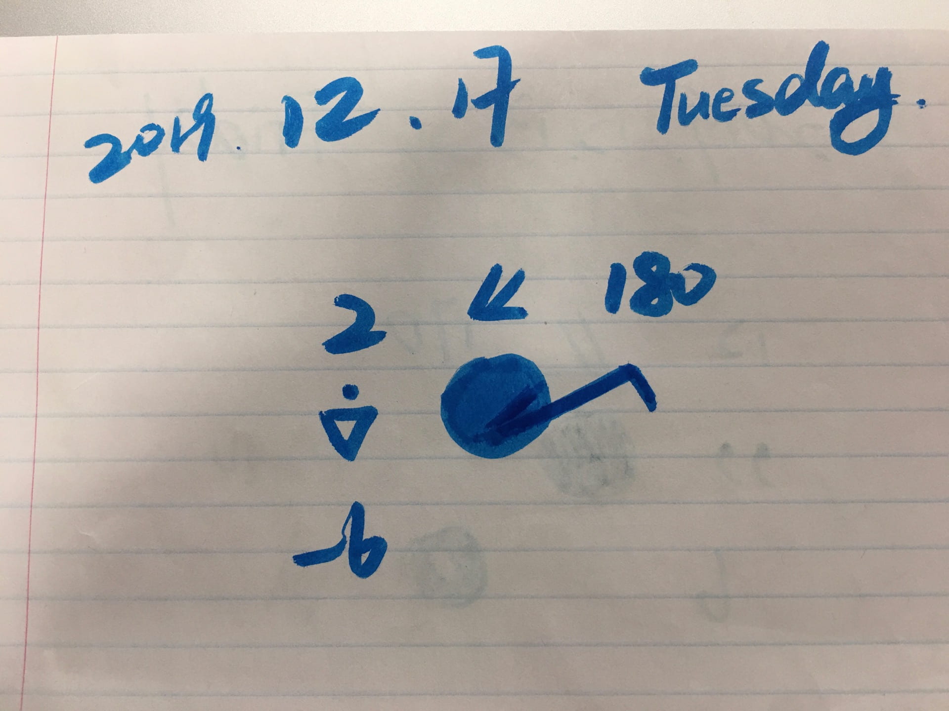
Date-December 18, 2019
Air temperature-2 degree
Wind direction- North East
Wind speed-4.74 knots
Precipitation-drizzle
Dew point – 6 degree
Cloud type- Nimbostratus
Cloud cover-full
Lower air pressure

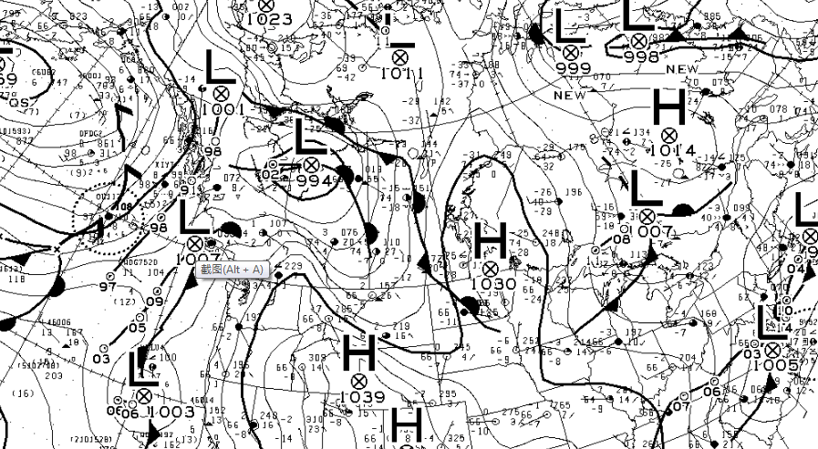
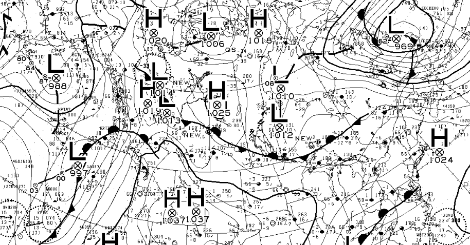
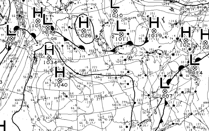
Map 1: There is lot of low pressure circling around which means that there will be lots of precipitation and clouds forming.
Map 2:

Map 3:
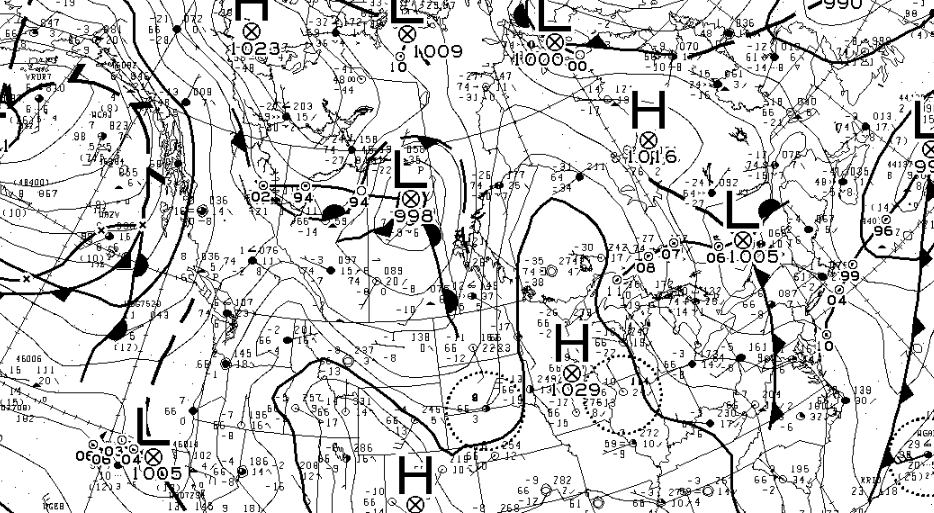
Map 4:More low pressure so there is more rain that is heading towards us.

Prediction:
From the data collected on the meteorological map, we see a swirling weather pattern centered on the low-pressure area. We think this will cause more clouds to form over us and cause precipitation, and the cold front in the vortex may lower the temperature a little bit.
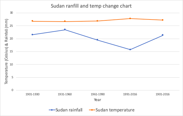
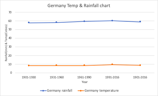

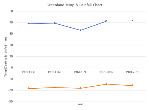
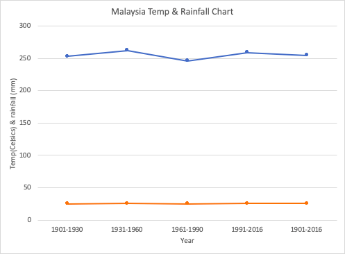
Blue: rainfall
Orange:temp

First, we noticed that the climate seemed to be increasing, but they were not increasing dramatically. It was observed that the climate in the tropical seemed to be increasing during the time period shown, with precipitation fluctuating but seems to remain near the same starting average.
During the time period shown, I noticed that the climate in the dry regions was fluctuating and precipitation was decreasing. The climate in the mild temperate zone is increasing, and precipitation is also increasing. Although they are not drastic changes.
Looking at the snow region the temperature is increasing, and precipitation is also greatly increasing. Finally, observing the polar region, averages seem to have a pattern to them through each period of time, the precipitation is increasing and within the last two time periods it has significantly increased.
Conclusion:From our observations we notice more climate change in the colder regions, as well as, the regions with precipitation increased. Precipitation is usually increased in the snow and polar regions more significantly then the other regions. Therefore, the low temperature zones will experience more rainfall due to the increasing temperature. However, the high temperature zones stay around the average temperature, but the rain is increasing.
Lina Pan & Varick Shen
Observation:
Date-December 17, 2019
Air pressure-1018.0 mb
Air temperature-2 degree
Wind direction- North
Wind speed-10 knots
Precipitation-rain shower
Dew point – -6 degree
Cloud type- Nimbostratus
Cloud cover-full
Lower air preesure
We predict that the cold regions in our south will cool down tomorrow. And continue the amount of precipitation and clouds we see, wind will be bigger tomorrow.
Map 1:
Map 2:
Map 3:
Map 4: