
Topography of Canada- Luca Saalmann, Andrew Hope
Read pages 16-23 Horizons (Chapter1)
- Cordillera
In the Cordillera region we can find:
- Mountains
As the oceanic plate subducts under the continental plate there are mountains or volcanoes formed.

Mount Waddington, the highest mountain in British Columbia (4019 meters)
- Fjords
As glaciers float down tot he sea they carve out rock. As they melt the water fills up the Fjord.

Western Brook Pond, Gros Morne Nationalpark, Newfoundland, Canada
- River valleys
In a river valley the river carves out the sediment rock so the valley gets deeper and deeper.

Hells Gate, British Columbia
- Interior plains region:
In the interior plains region there are valleys with river, flat lands as well as mountains.
- river valleys
- mostly flat land
Rivers coming from the Canadian Shield carried soil, which deposited and formed horizontal layers of sedimentary rock.
- rolling hills
They are less big and less steep than a mountain and are usually found in big areas with many hills.

Rolling Hills in Nova Scotia, Canada
- Canadian Shield Region
In the Canadian Shield Region there are mostly broad, flat areas and lots of lakes. That region can hardly be used for agriculture and it is hard to travel on the wet and soft soil.
- mostly flat landscape
- lakes
As glaciers float, they deposit in the soil. Because oft he soft soil in the Canadian Shield region the glaciers were stuck in the soil and as they melted they filled the whole in the ground with water. Special about those lakes is that they are usually not connected to a river.

Emerald alke, Canada
- wetlands
Wetlands are either covered or saturated by water which makes it hard to travel in that region. Another difficulty is that the soil is not really usable for agriculture.

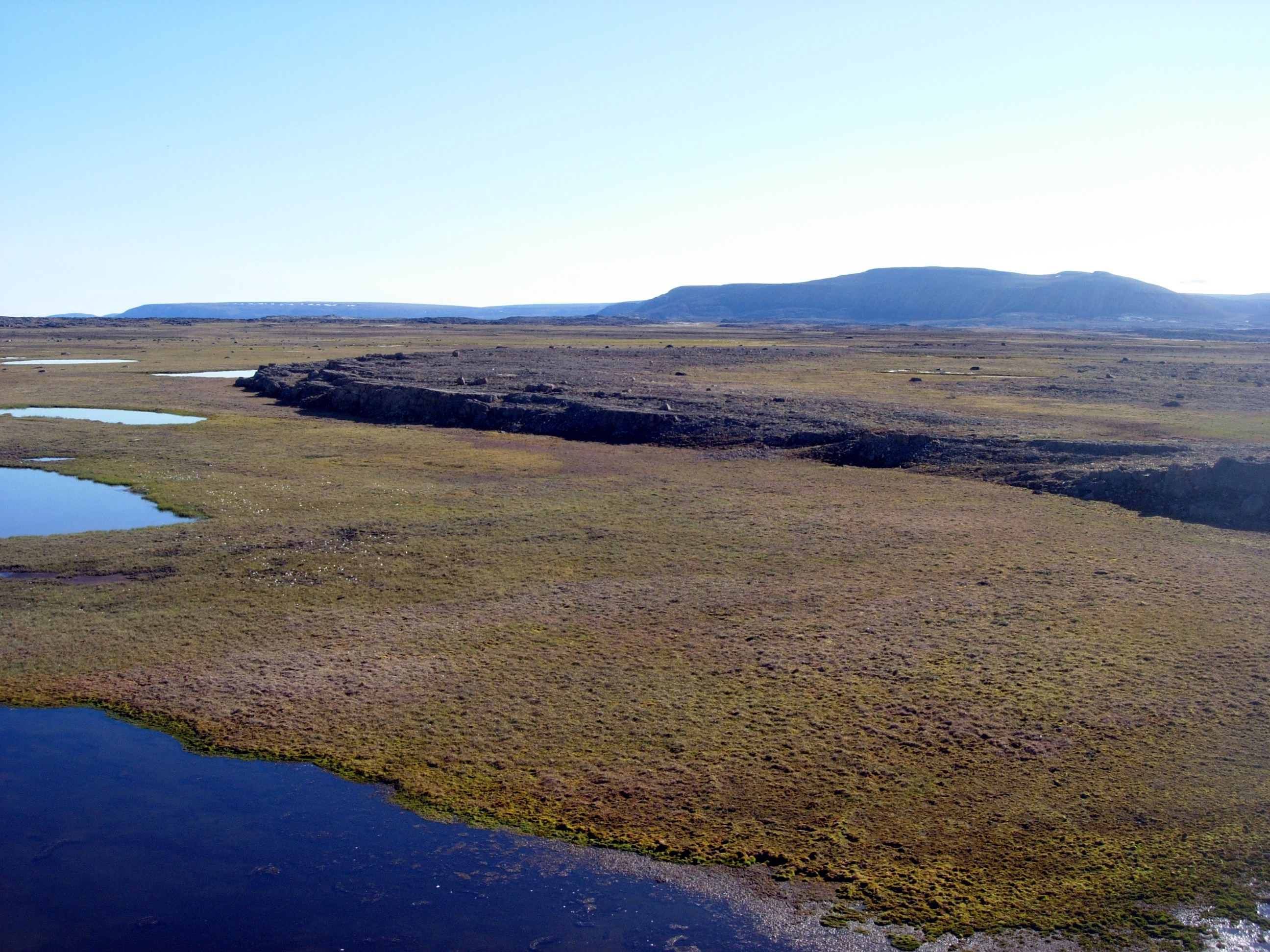
- The Arctic Region
The arctic region is thievery northern region of Canada. It is shaped by big mountains and still partly covered by ice. It is not usable for any economy because of the extremely cold temperatures.
- Plains
Plains are a broad area of relatively flat land. Grass ist he major vegetation, that is why another name for Plains is Grassland. They are formed as ice and water erode dirt and rock away in higher regions and carries them down to large deposits.

- Lowlands
The glaciers moved away approximately 7500 years ago and left sedimentary rock. The soil in the artic region is rich on oil, coal and minerals, but it is almost impossible to use it for agriculture.
- Mountains
The arctic mountains extend more than 1000 km across the northern arctic islands. The mountains in the arctic region are really high because they were formed by two colliding tectonic plates.
- The Appalachian Region
The Appalachian Region is the northern end of the Appalachian mountains. This region is higher elevated than most of the parts of Canada.
- Rolling hills
- Highlands
Highlands have barely any vegetation so they are unusable for agriculture. They are basically flatlands in an higher elveation.

- Fjords
Western Brook Pond, Gros Morne Nationalpark, Newfoundland, Canada
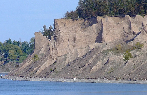
- The St. Lawrence Lowlands
- Lowlands
The Lowlands where formed by retreating ice sheets that pushed soil away to the region where the lowlands are today. The ice that covered most of Canada during the last ice age are completely gone today.
- Bluffs
Bluffs are formed by water eroding coastal rock and soil. The layers that were carried by that soil fall into the water and the process starts from the beginning.
- Rich Soils
The soils that were left behind when the ice was gone are rich on minerals and nutrients, which makes that region an important part of Canada’s agriculture.