Vegetation and Formation of Canada’s Physiographic Regions
The Arctic Region: Sub Arctic

These are the Ogilvie Mountains,in Yukon, it has a small valley and snow, which are results of being in the Sub Arctic ecosystem. Pressure from the north-eastern edge of the Canadian Shield pushed up the sedimentary rock to form a range of fold mountains.

Cordillera Region: Tundra, Open Woodland, Coniferous forest, Coast and Interior forest.

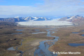
Tundra and large glacier on Bylot Island, Nunavut. I am aware that Nunavut isn’t part of the Cordillera region, but I thought this was a relevant enough picture. The Cordillera region is made up of lots of mountains that are separated by trenches, valleys and plateaus.

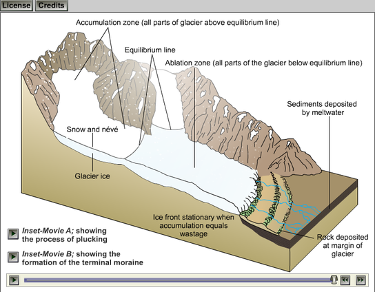
This diagram shows how valleys are made.
Interior Plains region: Tundra, Open Woodland, Coniferous forest, Parkland, Grassland.

Alberta Southern Prairies, this picture shows lots of Grassland, which is also one of the ecosystems. The Interior plains are made up of soil that was carried down by rivers from the Canadian Shield and deposited at it’s edge. These soils became flat lands, river valleys and rolling hills.
Another diagram on how valleys are formed.
Canadian Shield region: Tundra, Open woodland, Coniferous forest, Mixed forest.

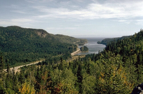
This picture was taken in Ontario, Canada. On this beautiful picture you can see rocks and Coniferous forest. The hard rigid rocks that take up half of Canada are often surrounded by younger continental landforms.

Coniferous Forests Diagram
St. Lawrence Lowlands region: Mixed forest.

Great Lakes, St. Lawrence. This picture contains lots of mixed trees, which indicates that it’s the Mixed forest. During the ice age, almost all of Canada was covered by ice sheets, these ice sheets retreated and pushed soils to make lowlands. When the ice sheets melted they made big lakes all over the St. Lawrence region.

This diagram shows how ice sheets retreat and deposit soil.
Appalachian Region: Open forest, Coniferous forest, Mixed forest.

Appalachian Mountains. As you can see on this picture, these mountains have lots of mixed forests.
The Appalachian region was an older range of mountains that was worn down by glaciers and by a million years of erosion, this made a varied landscape of rolling hills, valleys, small mountains, highlands, and coastal fjords.

The Arctic is missing a description of the vegetation type in a sub-arctic biome
For the Cordillera, you should be able to find a picture from it. Also, you should be discussing the plate tectonics involved in creating the region. The image also doesn’t show the vegetation.
Missing the formation of the Shield – it used to be a volcanic mountain range but was weathered down by glaciers to what it is today.
For the Appalachians, what are we looking for in the image? What does it mean by mixed forests?
Good layout but just missing some details.